3120 x 4252 px | 26,4 x 36 cm | 10,4 x 14,2 inches | 300dpi
Data acquisizione:
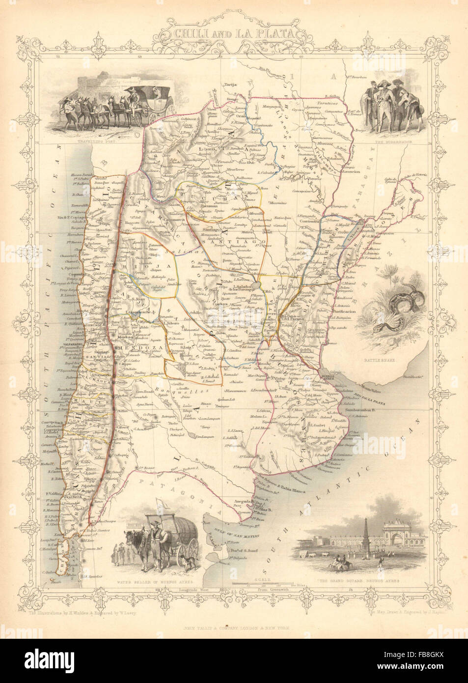
1851
Ubicazione:
South America
Altre informazioni:
Questa immagine potrebbe avere delle imperfezioni perché è storica o di reportage.
Artist/engraver/cartographer: Map drawn and engraved by J. Rapkin; vignette illustrations drawn by H Winkles & engraved by W Lacey. Published by John Tallis & Co. Provenance: "Tallis's Illustrated Atlas and Modern History of the World, Geographical, Political, Commercial and Statistical", edited by R Montgomery Martin Esq., published by John Tallis and Company, London & New York. Type: Antique engraved map by J Rapkin, published by John Tallis. Original outline hand colour, decorative border, and attractive inset vignette views. The map shows La Plata (Northern Argentina) and Chili (Chile). The Argentine/Paraguay border is that existing prior to the Paraguayan War (Spanish: Guerra del Paraguay; Portuguese: Guerra do Paraguai), also known as the War of the Triple Alliance of 1864-1870, as a result of which Paraguay ceded territory to Argentina. Vignettes: Travelling Post; The Gobernador; Rattlesnake; Water Seller of Buenos Ayres; The Grand Square - Beunos Ayres [Buenos Aires]; The map includes Argentina, Southern Brazil & Paraguay