10942 x 9419 px | 92,6 x 79,7 cm | 36,5 x 31,4 inches | 300dpi
Data acquisizione:
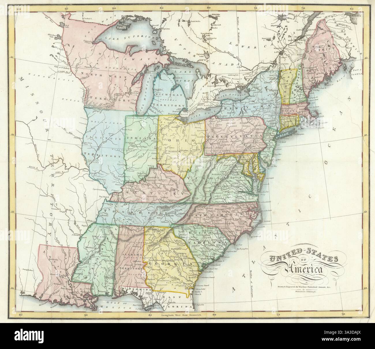
1819
Ubicazione:
USA
Altre informazioni:
Questa immagine potrebbe avere delle imperfezioni perché è storica o di reportage.
United States of America. Artist/engraver/cartographer: William Home & Daniel Lizars, Edinburgh. Provenance: "A Statistical, Political, and Historical Account of the United States of North America; from the Period of Their First Colonization to the Present Day", by D. B. Warden, Late Consul for the United States at Paris. Edinburgh: Printed for Archibald Constable and Co. Edinburgh; Longman, Hurst, Rees, Orme, and Brown; and Hurst, Robinson, and Company, London. Type: Antique engraved city plan. A rare 1819 map of the United States by William Home Lizars and his brother David. The map names and delineates the first 20 states admitted to the Union (up to and including Mississippi in 1817), plus Illinois Territory (admitted as the state of Illinois in 1818), Alabama Territory (admitted as the state of Alabama in 1819), Michigan Territory (part of what was admitted as the state of Michigan in 1837), North West Territory & Missouri Territory to the west of the Mississippi River. The map covers in detail the region between the Mississippi River and the Atlantic Seaboard, and from the Great Lakes to northern Florida and the Gulf of Mexico. Cartographic detail is sparse west of the Mississippi, where it includes some Native American settlements. Areas and settlements populated by American Indian Tribes prior to the 1830 Indian Removal Act are marked across Mississippi, Alabama, Georgia and Tennessee. This map appeared in David Baillie Warden's "Statistical, Political, and Historical Account of the United States of America".