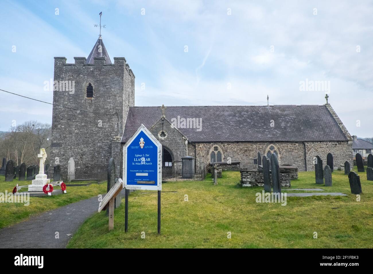
Chiesa di Sant'Ilar (Eglwys Sant Ilar), che è un edificio storico di grado II probabilmente risalente al XIV century.in villaggio di Llanilar. Nelle vicinanze si trova lo Ystwyth Trail, un 21 miglia, 34 km, percorso multiuso, utilizzato, da cani escursionisti, escursionisti, ciclisti, joggers, e in parte a cavallo, per i cavalieri. L'ex linea di sentiero collega la città costiera studentesca di Aberystwyth, ON, Cardigan Bay, a Tregaron, entrambi, in Ceredigion. Il sentiero è prevalentemente lungo il fiume Ystwtyh. Fotografia scattata tra il villaggio di Llanilar e Transgoed,rurale,campagna,scenario,Ceredigon,Galles,Galles,UK,GB,
6708 x 4472 px | 56,8 x 37,9 cm | 22,4 x 14,9 inches | 300dpi
Data acquisizione:
8 marzo 2021
Altre informazioni:
Questa immagine potrebbe avere delle imperfezioni perché è storica o di reportage.
The Ystwyth Trail is a 21-mile (34 km) multi-use rail trail linking Aberystwyth, Llanfarian, Ystrad Meurig and Tregaron in Ceredigion, Wales.[1] Cycling and walking are permitted along the entire length while horseriding is permitted on several sections only. The £1.7m Ystwyth Trail was partially completed in September 2008 and runs along part of the former redundant track bed of the Old Manchester and Milford Railway, a Great Western Railway branch line. It remains incomplete, as several sections of the former railway line were not purchased to create the trail due to extensive lobbying by local councillors of Ceredigion County Council against the trail, as existing landowners and farmers objected to the construction of the trail. Diversions of the trail have now been carried out onto narrow sections of existing public roads to link these missing sections, but this has created a non continuous trail with intermediate road sections on narrow roads which have considerable safety issues due to their narrowness, many bends and no traffic speed limits. Due to these objections and lobbying, it is unlikely that this trail will be developed or completed any further. Anglican parish church, rubble stone with slate roofs, nave and chancel in one, W tower, C19 S porch and N vestry. Tower is broad with battered base, W recessed pointed door with ashlar voussoirs, renewed in 1874, and 1874 2-light pointed window above with quatrefoil in head, and small single light above. NE stair projection with 2 small loop lights. Bell-openings are of 1874, single pointed cusped lights with louvres. Battlement without corbel course below, with C19 rock-faced stone coping. Recessed slate octagonal short spire with weathercock. Buttress at SE at joint with nave. Nave windows of 1874 are The Ystwyth Trail links with other routes via Lampeter and Devil's Bridge creating a link with both the Lôn Cambria and Lôn Teifi long distance cycling routes (Sustrans national network routes 81 and 82).
Disponibile solo per utilizzo editoriale.
Uso relativo a notizie, recensioni e critiche e alla comunicazione di informazioni che riguardano persone, luoghi, cose, eventi o avvenimenti.
Per maggior chiarezza, l'uso editoriale non include alcun uso relativo a pubblicità, promozione (ad esempio siti web promozionali), marketing, packaging o merchandising.