Questa immagine potrebbe avere delle imperfezioni perché è storica o di reportage.
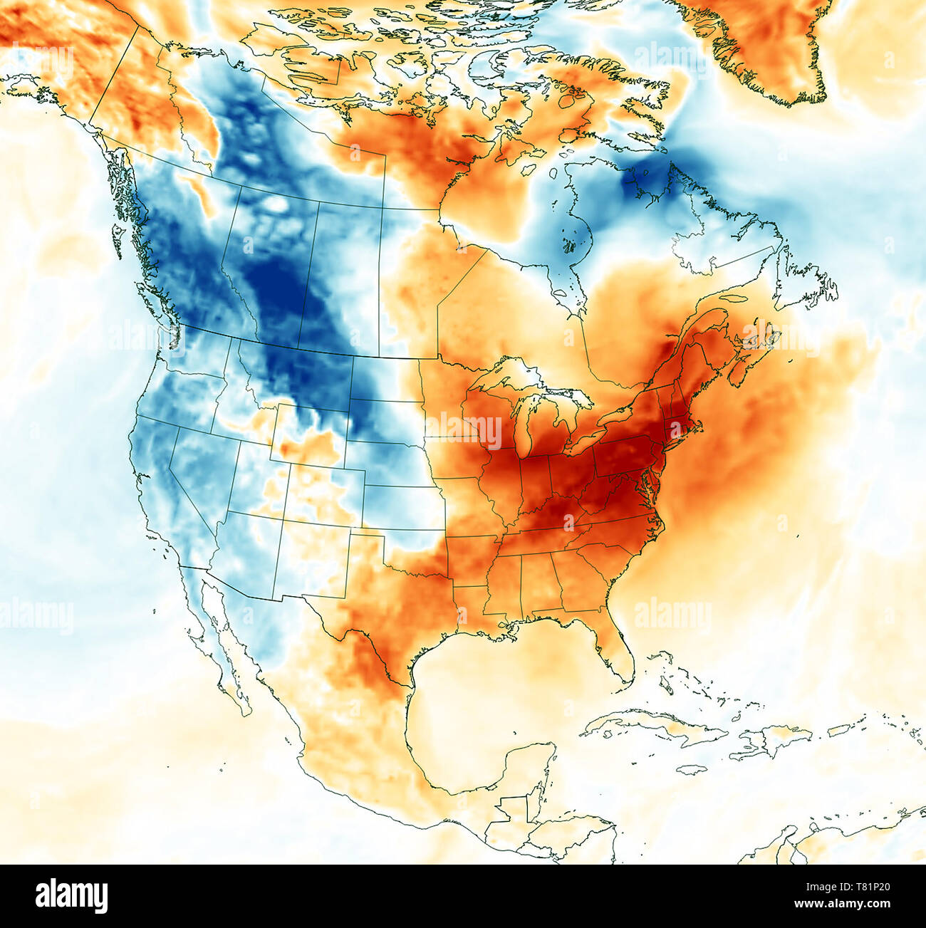
Extreme cold struck the middle and eastern portion of the United States in late January 2019. Unseasonably warm air arrived in early February, sending temperatures soaring to record daily highs in some eastern cities. This map shows the change in air temperatures between January 29, 2019, and February 5, 2019. The map was derived from the Goddard Earth Observing System (GEOS) model, and represents air temperatures at 2 meters (about 6.5 feet) above the ground. The darkest red areas represent a jump in temperature by as much as 25 degrees Celsius (45 degrees F). Daily high temperature in New York, Boston and Washington D.C. rose about 26°C (47°F) between January 29 and February 5. Meanwhile, parts of the U.S. west saw a drop in temperature cold enough for snow to fall in many areas, including the San Francisco Bay Area and Napa Valley.