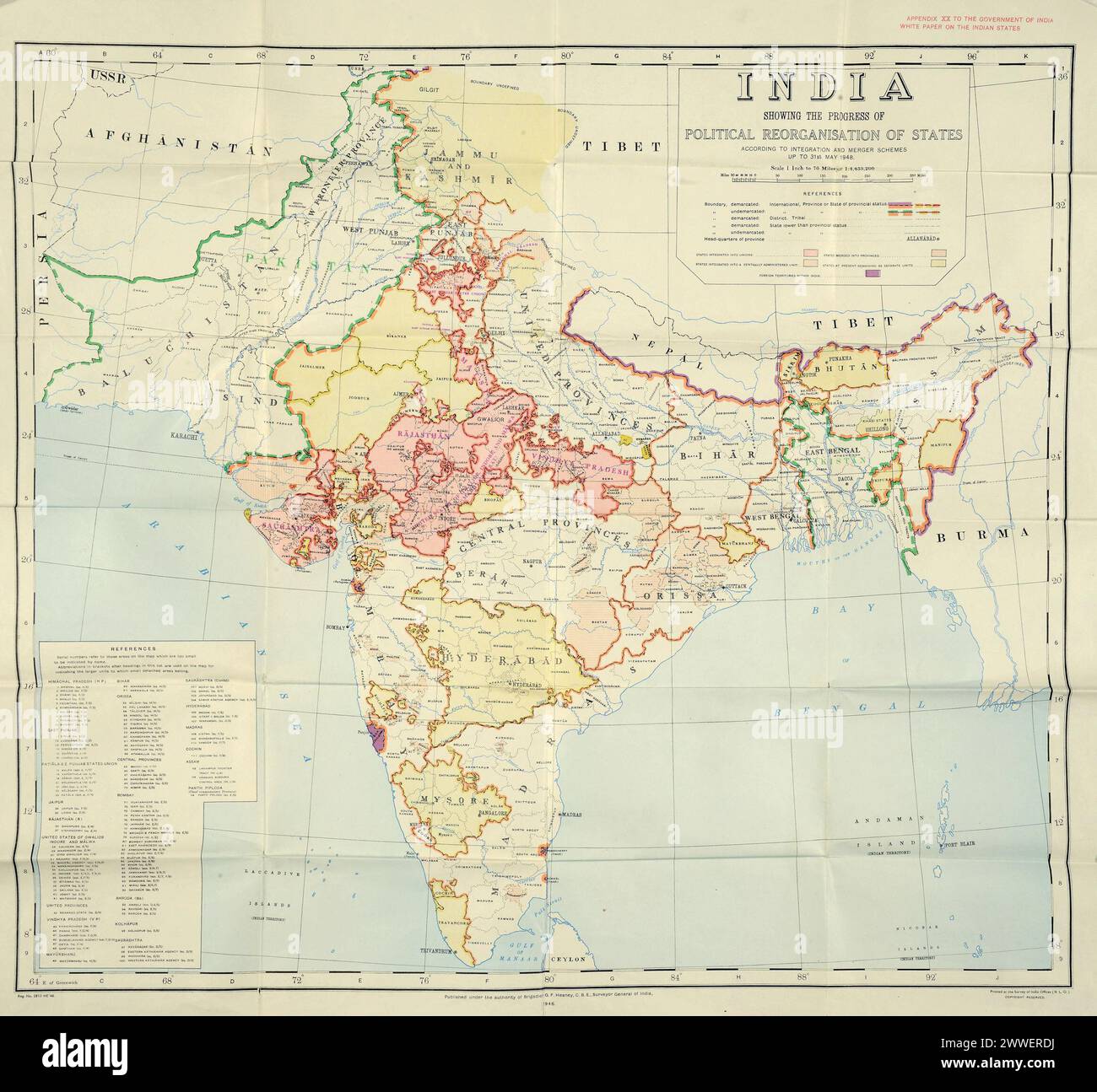
Una mappa del 1948 che illustra la divisione dell'India britannica nelle nazioni indipendenti di India e Pakistan. Mostra i confini appena tracciati basati su maggioranze religiose e le migrazioni su larga scala e la violenza che hanno seguito la divisione.
2322 x 2153 px | 39,3 x 36,5 cm | 15,5 x 14,4 inches | 150dpi
Data acquisizione:
1 gennaio 1948
Altre informazioni:
Questa immagine potrebbe avere delle imperfezioni perché è storica o di reportage.
Map of the partition of British India Document: India's plan for uniting and merging Indian States, 1948. Catalogue Ref: DO 142/484 (1) Description: This map illustrates the new borders that resulted from the partition of British India. The partition of British India happened in August 1947 when the British government withdrew after almost two hundred years of British rule. It is called 'partition' because this withdrawal resulted in two new independent nations: India and Pakistan. The borders of these new countries were based on religious majorities and went straight through existing provinces. Many people living in the regions affected by partition felt scared and uncertain about their future – not wanting to end up on the ‘wrong side’ of the border. In the months around August 1947 over 15 million people are thought to have migrated across the new borders, accompanied by brutal violence. Learn more about the partition of British India with our new online resource 'Partition of British India', which includes an 11-minute video and lesson plan: indiansubcontinent, international