1166 x 1912 px | 19,7 x 32,4 cm | 7,8 x 12,7 inches | 150dpi
Data acquisizione:
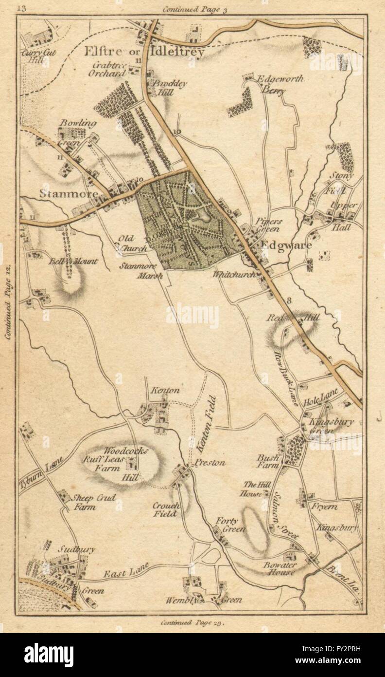
1786
Ubicazione:
London
Altre informazioni:
Questa immagine potrebbe avere delle imperfezioni perché è storica o di reportage.
'[Map section 13] This antique map section contains all or part of the following modern suburbs/towns/villages: Stanmore, Elstree, Edgware, Sudbury, Wembley Park, Kingsbury, Preston, Forty Green, Burnt Oak, Barnet Gate, Highwood Hill, Queensbury, Colindale, Neasden'. Artist/engraver/cartographer: J Cary. Provenance: "Carys actual survey of the country fifteen miles round London."; On a scale of one inch to a mile. Wherein the roads, rivers, woods and commons as well as every market town, village &c. are distinguished; and every seat shewn with the name of the possessor. London: printed for J. Cary, engraver, map and print seller, no 188 Strand. Published as the Act directs, June 20 1786. Type: Antique hand coloured engraved map. Scale one inch to a mile. [Map section 13. Continuation to the north on map section 3. Continuation to the south on map section 23. Continuation to the west on map section 12. Continuation to the east on map section 14]