1920 x 1080 px | 32,5 x 18,3 cm | 12,8 x 7,2 inches | 150dpi
Data acquisizione:
2012
Altre informazioni:
Questa immagine potrebbe avere delle imperfezioni perché è storica o di reportage.
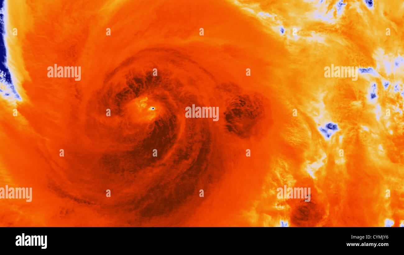
Satellite Captures Detailed Imagery of Hurricane Sandy Intensification Early in the morning on October 25, 2012, the Suomi NPP satellite passed over Hurricane Sandy after it made landfall over Cuba and Jamaica, capturing this highly detailed infrared imagery, showing areas of deep convection around the central eye. Besides the highly detailed infrared imagery, the satelliteÕs day night band captured detailed visible-like imagery of the cloud tops, along with the city lights of Puerto Rico and the Virgin Islands. As most polar-orbiting satellites fly over an area, the visible and infrared sensors scan left to right. Data in the center part of the scan typically has the highest resolution and quality; farther out in the scan, the imagery gets distorted. An improvement in the Suomi NPP's VIIRS sensor over its predecessors reduces the loss of data quality along the length of the scan. Hurricane Sandy is a perfect example of the importance of this improvement Ð both times the satellite passed over Sandy on October 25th in consecutive orbits, the storm was on the edge of the scan area, which would have meant decreased image quality from previous satellites, but not Suomi NPP. Only at the very limits of the imagery (left hand side) can the edge of scan issues be seen in the day-night band image. These distortions would be much more pronounced in similar imagery from AVHRR or MODIS.
Questa immagine non può ottenere una licenza per pubblicità o promozione.