5200 x 3900 px | 44 x 33 cm | 17,3 x 13 inches | 300dpi
Data acquisizione:
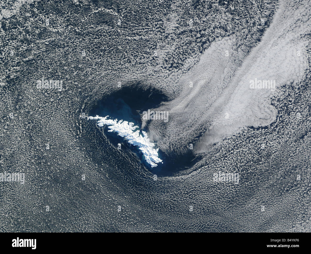
8 agosto 2002
Ubicazione:
South Georgia Island, Southern Atlantic
Altre informazioni:
Located in the Southern Atlantic Ocean roughly 1 700 miles 2 735 km due east of Argentina s southernmost tip South Georgia Island was a stop over point for Sir Ernest Shackleton in November 1914. Sailing aboard the Endurance Shackleton was on his famous expedition to be the first to travel across Antarctica from sea to sea and across the South Pole. At that time the island was home to only a small whaling village on its northern shore In April 1915 with his mission failed and most of his crew stranded on Elephant Island some 800 miles 1 287 km to the southwest Shackleton returned to South Georgia Island in a lifeboat with some of his men rowing through blizzard like conditions and later riding out a hurricane just off South Georgia Islands southern shore. Shackleton eventually made landfall and quickly set out again on a rescue expedition to Elephant Island where he successfully recovered the rest of his crew. Today Shackleton lies buried in a small cemetery at Grytviken. South Georgia Island is entirely covered by snow and ice in this striking true color image acquired by the Moderate Resolution Imaging Spectroradiometer MODIS flying aboard NASA's Terra satellite on August 8 2002. Some 105 miles 170 km long and varying from 1 to 25 miles 2 to 40 km wide the island itself resembles a carved and weather-beaten whalebone. The many dark shadows contrasting with the bright white surface reveal a rugged terrain with eleven mountain peaks across the island standing taller than 2000 meters. 6560 feet Mount Paget 's peak located near the center of the island is the tallest standing roughly 2 900 meters 9515 feet. Many boundary layer cumulus clouds fill the atmosphere in the larger region surrounding the island in this scene. Toward the upper left hand corner of the image a number of sinewy patterns snaking across the cloud bank indicates open cell convection.