8038 x 9900 px | 68,1 x 83,8 cm | 26,8 x 33 inches | 300dpi
Data acquisizione:
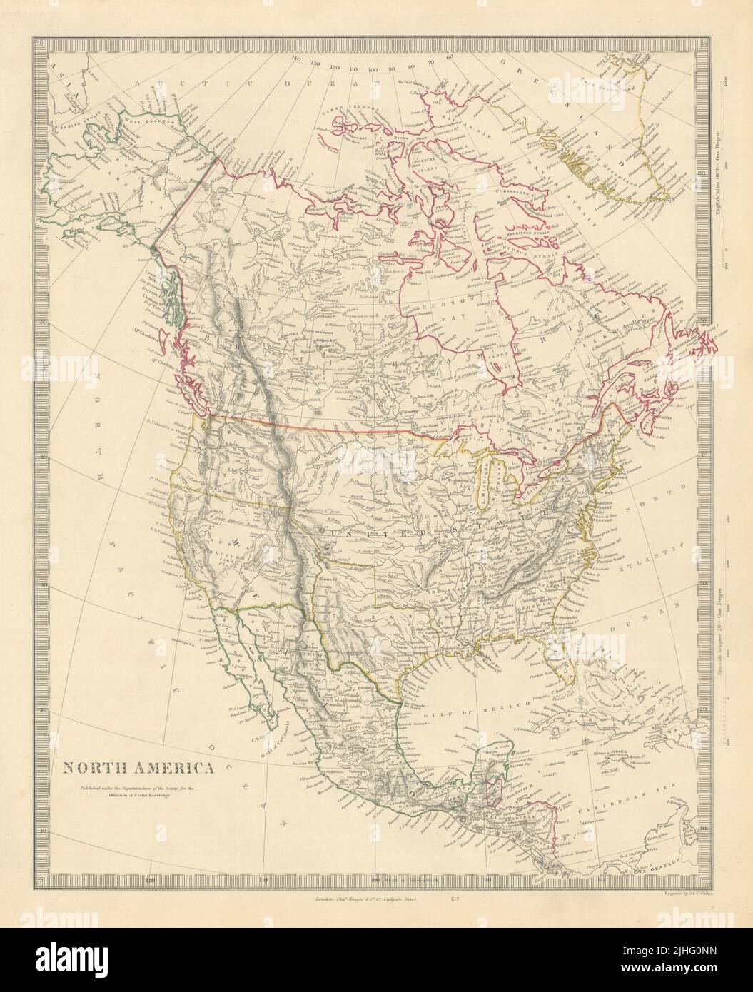
1851
Ubicazione:
North America
Altre informazioni:
Questa immagine potrebbe avere delle imperfezioni perché è storica o di reportage.
NORTH AMERICA. Artist/engraver/cartographer: Engraved by J & C Walker. Provenance: "Maps of the Society for the Diffusion of Useful Knowledge. A new edition, corrected to the present time", published by Charles Knight & Co, 22 Ludgate Street, London [SDUK Atlas]. Type: Antique steel engraved map with original outline hand colouring. The borders printed on the map reflect national boundaries as they existed between 1836 and 1845 during which period the map was engraved, including the Republic of Texas as an independent state, and the US-Mexican border prior to the Mexican-American war of 1846-1848 with the present US state of California being shown as part of Mexico. The border between the United States and British North America (now Canada) printed on the map reflects the position prior to the Oregon Treaty of 1846 along the Columbia River. The national borders indicated by the later hand colouring, applied at the time of publication, differ from the printed borders. The Texas Republic, and those parts of Mexico ceded to the United States are delineated in yellow. The US/Canada border is coloured to reflect its status as settled in the Oregon Treaty. The map also shows what is now the US state of Alaska as "Russian America", as it was prior to the Alaska purchase of 1867.